JULY 25, 2015
MUNISING, MICHIGAN
We have experienced some really poor Internet service over
the past few days – even when using my iPhone as a hotspot. All of the campgrounds have free Wi-Fi but
the speed has been very slow and getting text let alone pictures posted has
been impossible. I found that I could get marginal Internet this morning - so the latest post has gone live.
We left Superior, Wisconsin,
Thursday morning for Munising, Michigan. The distance was only 270 miles but it was completely
over 2-lane 55 mph roads that dropped to a 25 mph speed limit through every
little community spaced about 10 miles apart.
I was more than ready to stop when we pulled into the Munising
City campground.
We are on the northern shore
of Lake Superior and are fortunate
enough to have a huge site. The
campground is full due to this being the prime tourist season up here. Now, when I say “up here” that’s exactly what
I mean. This is about as far north as I
would ever want to be. Munising is part of what is called the "Upper Peninsula", or to the locals the "Yoouper Peninsula"
Today’s high temperature did not even hit 70 and the need for A/C in the camper has been minimal. Looking at the weather forecast for Sunday it will not even get up to 60. The surface temperature of the lake water is reported to be about 56 degrees and quickly drops to 40 degrees about 5 feet under the surface. While I have absolutely no desire to even wade in this cold water there are a whole bunch of folks with blue lips playing in the water.
Today’s high temperature did not even hit 70 and the need for A/C in the camper has been minimal. Looking at the weather forecast for Sunday it will not even get up to 60. The surface temperature of the lake water is reported to be about 56 degrees and quickly drops to 40 degrees about 5 feet under the surface. While I have absolutely no desire to even wade in this cold water there are a whole bunch of folks with blue lips playing in the water.
One of the popular meals here is called a “Pastie”. Where I grew up a pastie was something you
would find in a strip club covering a part of the female anatomy. The pastie here is what I would call a “Pot
Pie”, but there is no pot. It is a huge
baked roll all sealed up with a mixture of meat and vegetables inside. It is served with gravy and slaw. The story behind this is that the miners in
this area took them to work in a paper bag for lunch. They were stuffed with any leftovers in their
household.
We had our lunch at a local eatery called Muldoon’s. Nancy and I ordered the chicken pasties. Some of the others in our group ordered
beef. They were tasty but IMHO had too
much bread. I ended up not eating the
bottom of my roll.
This afternoon we took a sightseeing boat tour on Lake
Superior along the tall rock cliffs know as the Picture Rocks. The boat was a 60 foot craft that carried
maybe 50-60 people. The crew member that
narrated the tour did an excellent job of telling us about the area, Lake
Superior, ship wrecks and winter weather. Lake Superior is the
largest of the Great Lakes. It is actually the third largest fresh water
lake in the world! In square miles it is bigger than North Carolina. It is hard to imagine
that it was cold enough this past winter for the entire lake surface to freeze. That just boggles our minds. Just like the ocean, you look across the lake
and do not see the other side. While the
water was calm today, when the wind picks up the lake can have waves over 20
feet high and is the graveyard for many ships.
Yet right now, you will find folks in canoes and kayaks skimming along
the shore line.
Tomorrow we will probably just check out the quaint little
town of Munising if it is not
raining – which is a good possibility.
Sunday we leave here for Mackinac City,
Michigan. Mackinac is also considered part of the Upper Peninsula of Michigan.
This will take us across the Mackinac
Bridge ($20 toll) and down the east
side of Lake Michigan.
While this area does not have the awe we experienced in the Badlands
and mountains back west, it is uniquely beautiful and different than the
landscape we are familiar with back home.
But, no matter how beautiful it is, I would not want to live here in the
winter.
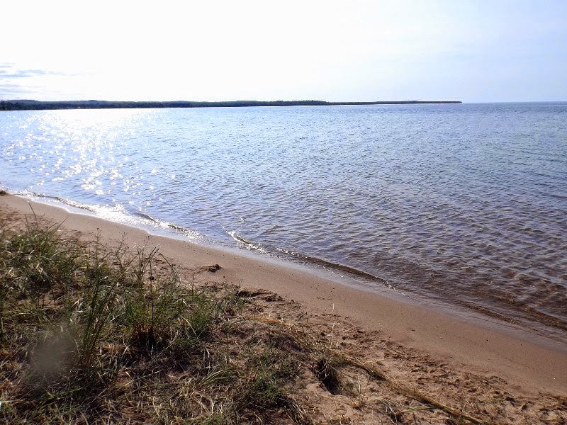
Shore line of Lake Superior at our campground

Our campsite in Munising.


Mr. Muldoon?
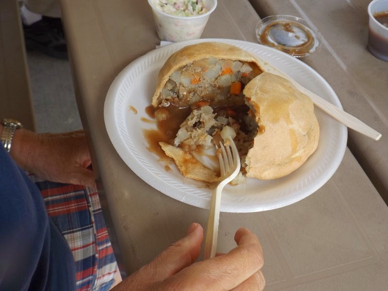 This is a Pastie.........
This is a "sister" boat to the one we were on for the Picture Rocks Tour
All of the Photos below were shot from the boat on the tour. The colors in the rocks (limestone) are from minerals being pushed into the rock by water pressure and then dripping back down. The caves and arch are all from erosion of softer rock.


The water in shallow areas appeared green. You could easily see the bottom in 20 feet of water as shown here.

This is a waterfall (or infall) at a place called Mosquito Beach. Keep in mind the water is COLD and outside temperature 69 degrees. We watched these kids slide down the rocks under the waterfall.


No comments:
Post a Comment