Saturday, July 12, 2014


Ten Sleep Canyon Walls

CODY WYOMING July 13, 2004

I think we must be on another planet!

We have seen the landscape of western South Dakota and Wyoming on TV shows and in the movies but seeing it first hand with your own eyes is simply awesome.

We left Custer, SD about 8:00 a.m. this morning heading for Cody.  We were not more than 10 miles out of Custer when we ran into road construction.  But, unlike the construction we are accustomed to back home they simply tear the existing road out and leave a dirt trail for traffic to follow.  The light rain last night turned the dirt into mud that is all over the truck and camper.  We did not get back onto solid pavement until we crossed the state line into Wyoming.  There we picked up I-90 and rolled over some of the most amazing landscape we have ever seen for about 100 miles.  The highway is basically flat with some rolling hills.  You can see ahead until the road disappears over the Horizon.  The speed limit here is 80 mph, which is pretty much a joke as we were constantly passed by cars like we were standing still (our speed was about 65 mph).  Small oil wells dot the landscape along with cattle, horses and Mule Deer.  There are bright red-topped mesas that rise abruptly like and hills.

We exited I-90 onto US 16 at Gillette, WY, and began our climb over what is known as the Big Horn Mountain and The Sweet Sixteen.  This route takes you through the Big Horn Notational Forest along the Cloud Peek Scenic By-way.  This was unlike anything we have ever climbed.  We kept going up, up, and up for miles until we finally hit the top at over 9,000 feet elevation.  Other than an airplane, this is the highest I have ever been that I can remember.

Going down the mountain was even more exciting.  The road was narrow with switchback turns and a frail guard rail separating us from the canyon below.  There were several places where the guard rail was pushed out or broken.  I guess some poor soul took the wrong route.

Having both an exhaust brake and an engine compression brake was a blessing.  I shifted down to 8th gear and let the engine do most of the downhill braking.

There are no houses out here.  Wayne was running low on diesel fuel and the one station we found in some little town did not have any diesel fuel.  Fortunately Lee has an auxiliary fuel tank in the bed of his truck and transferred about 10 gallons of diesel into Wayne's tank.  We had plenty of fuel but no way to transfer it to another vehicle.  We would be in sorry shape if we had a breakdown out here and needed a tow truck.  Traveling with friends on this highway is our only security.

Back on relatively flat ground we got into Cody some 8 hours and 360 miles later.

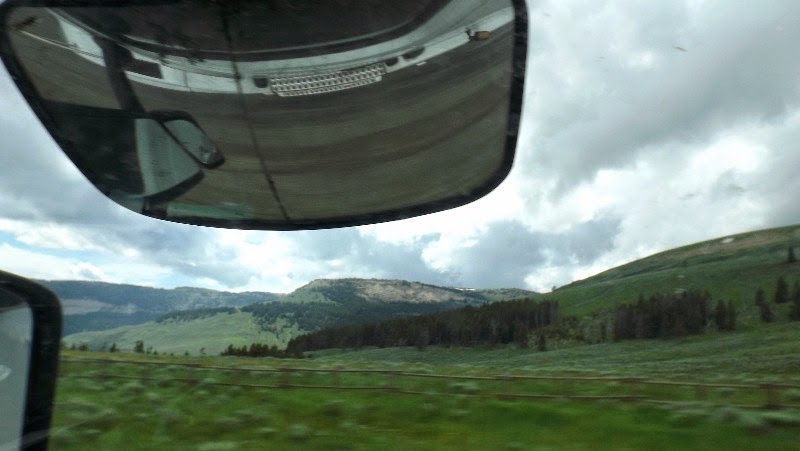
Nancy made over 100 photos as we were crossing the landscape.  Trying to decide which ones to share is a real dilemma.

We are set up on a level campsite in Cody and I am ready to call it a day and go to bed.  Tomorrow we will check out Cody and then go into Yellowstone Monday.  

Remember, if you are using a PC you can click on any picture to enlarge.  This feature probably will not work on a Smart Phone. 

Photos are not sorted in order due to a very slow internet connection.  But, I think you can get the general idea.  There are many, many more that I do not have the bandwidth to share now..

Yes, the sign is real.  The speed limit on I-90 is 80 mph.  Like most Interstate highways, this means drivers go 10 to 15 mph fastener than the posted speed limit.

 Yes, that is 9,055 feet above sea level as we crossed the top of Big Horn and began our decedent into Ten Sleep Canyon..

Down on flatter ground, mounds rise like the Egyptian Pyramids.

The rock walls and formations going down the mountain and into the canyon are breathtaking.

On I-90 before Highway 16 the road just seems to disappear on the horizon into the Big Horn mountains.


 The dirt road we had to follow out of Custer.

Small oil wells dot the landscape.  I wonder how it would be to have an oil well in your backyard?  Other than an occasional bovine critter or oil well, the signs of human life out here are far and few between.


 That white stuff on the mountain is SNOW left over from winter.  We are at a little over 8,000 feet elevation.


Looking down into what is part of Ten Sleep Canyon.

Thursday, July 10, 2014


THURSDAY, JULY 9, 2014

CUSTER AND DEADWOOD, SD

Another extremely busy day.  There is so much to see here.  The Black Hills are beautiful and the history of this part of the country has become real - it is no longer just a tale or story.  Wild West gun fights, saloons, pioneer settlements, gold mines, Indian tribes and lifestyles …… it just goes on and on.

This morning we once again left camp at 9:00 a.m.  Our first stop was at the CRAZY HORSE monument.  This is a gigantic undertaking to carve (sculptor) a figure of Crazy Horse riding his stallion while pointing out to the lands once owned by the Native Americans.  The monument is being cut out of solid rock in a manner similar to Rushmore.  Blasting away pieces of granite, drilling, chipping and even sanding.  The figure is far from complete - in fact it will never be complete in my lifetime.  The story behind this project is one that should be of interest to everyone.  It is a story of love, ambition and determination to honor the Native American people and it is not taking one thin dime of taxpayer money.  All income is derived from donations and admission fees.

Below the emerging figure of Crazy Horse and his stallion is a beautiful museum and gift shop showing Indian made crafts, clothing, hunting and fighting weapons and tools.  Some are for sale, such as jewelry, while others are part of the collection on display.

After we left Crazy Horse we drove through the Black Hills crossing several very steep mountain grades, to the town of Deadwood, SD.

Deadwood is one of many small towns in this part of the country that have some significant tie to a historic hero, event or structure.  This is the place where Wild Bill Hickock was shot in the back on August 3, 1876, by Jack McCall while Wild Bill was playing poker in a saloon.  Wild Bill was a U.S. Marshall that captured outlaws throughout the west in Abilene, Dodge City, Hays and Nebraska.

In the saloon at the time of the killing, Calamity Jane, who was a girlfriend of Hickock, cradled the dead Hickock as she yelled, "The villain, the dirty rat, I'll get him."

Hickock was quickly buried in a pine box up on Boot Hill.  The cemetery sits on what is now named Mount Moriah.  When Calamity Jane died some years later she requested that she be buried next to Wild Bill.  She got her wish and the two graves are side-by-side.

While visiting the grave sites we notices small rocks and coins stacked on or near the headstone.  On the headstone of Calamity Jane there were to small (full) bottles of Jack Daniels Old No. 7 whiskey.  When I asked what all of this meant I was told it was a traditional way for visitors to show that they had visited the grave.

Again, it was an interesting and extremely busy day.  Nancy and I had a lot of fun and were completely exhausted by the time we got back to the camper.

The next stop will be Cody, WY just outside of Yellowstone.  We have been told that if we got tired being tourist here that Cody will wear us completely out.  So much to see and not nearly enough time.  We could spend a month here and still not see it all.


 Crazy Horse Monument.  Work is not complete.

 1/34th scare of what the completed Crazy Horse Monument will look like.

Specs for the completed monument.

Inside the Native American Museum at the Crazy Horse Monument.


Entering Deadwood.  Notice the population.  It is still a small town literally built into the side of a mountain


Downtown Deadwood.  (Click on the smaller images above to view larger size.)


Actors doing a reenactment of a street shootout.  They did a great job. (Click on the smaller images above to view larger size.)


Casino's with slot machines and card games are in just about every restaurant and saloon.  We ate lunch here.  There was a blackjack game going on behind us.  You can see the glitzy lights of the slot machines around the dining room.  No, neither one of us put anything into the machines. 


Cemetery and graves of Wild Bill Hickock and Calamity Jane. Note the small bottles on Calamity Jane's marker.  (Click on the smaller images above to view larger size.)
.

Tuesday, July 8, 2014


TUESDAY, JULY 8, 2014

CUSTER SOUTH DAKOTA

Being so tired from yesterday's long drive we decided not to leave the campground until 9:00 a.m.  Of course this is equivalent to 11:00 a.m. back in Virginia so it is a good time for us to get up and start moving.  It got pretty chilly this morning with a low of 50 degrees.  The extra blanket really helped last night - we even turned on the electric heater in the fireplace this morning.  See have not need any air-conditioning.  The forecast looks a little warmer for the next few days but nothing like the humidity and heat-index we left behind in Kearney and Branson.

We rode with Wayne and Margaret since our desired route would take us on some extremely narrow roads and through some tunnels that the Volvo simply would not fit through.  One tunnel was only 8'6" wide and 10' high.  I would have lost at least 3 feet off the top if I tried to go through that tunnel!.

Monday, July 7, 2014


MONDAY JULY 7, 2014
CUSTER, SD

We left Kearney this morning a little after 7 a.m. Central time.  Our route took us up I-80 and then onto US-26 and US-385.  This is the longest leg of our journey being 420 miles in one day. 

The landscape was beautiful.  Starting in Kearney, NE with miles and miles of corn and flat, long roads with only a few scattered homes in sight we began to slowly climb from an elevation of 2016 feet to our present elevation in Custer, SD of 5548 feet.  Compared to our home in Virginia we are over a mile higher.  I can tell, too.  As we climbed there was a slightly noticeable difference in the power and performance of the truck.  I’ve been told you lose up to 5% efficiency for every 1,000 feet.

Back to the flatter lands, we stopped in Alliance, NE to see Carhenge.  Now, this is a crazy display of old cars stacked and buried as an exact replica of Stonehenge.  Every angle, height and piece was precisely placed.  There were old Plymouth’s, Cadillac’s, Gremlin’s, Lincoln’s, Valiant’s, Jeep’s and more sprayed with what appeared to be a coating of cement.  Really a strange exhibit.

As we moved further west our elevation continued to increase as we reached The High Plains and the Sand Hills of Nebraska.  The sand hills strangely resembled the dunes near the ocean in North Carolina.  This is railroad country for sure.  We saw miles of trains loaded with coal heading up and down a set of parallel tracks all along the highway.  Farming and corn were not as prominent and the landscape was replaced by scrub and grass with only an occasional tree.  Wayne commented over the CB radio that if we were in the old west where they hung outlaws from a tree that they would have to plant one and wait for it to grow big enough for a hangman’s noose.

As wee crossed into South Dakota the landscape immediately changed as the Black Hills appeared.  We had a lot of climbing and curvy roads to navigate.  We had a strong head wind that pushed the camper and truck around.  My estimate would be 30 to 40 mph winds.  Huge dust clouds engulfed the highway thick enough to obscure visibility and left a gritty feeling in my mouth even with the windows closed and the A/C running.

As wee went through Wind Cave National Park a herd of Buffalo came charging across the highway.  Wayne was in the lead and had to make a rapid stop to keep from hitting a young bull.  Nancy was ecstatic and busy with the camera taking as many pictures as possible.  It was exciting as we have never watched wild Buffalo before.

We continued to climb hill after hill until we finally arrived at our campground.  I can’t say it is the fanciest place we have been but we do have a full hook-up and a 70 foot long pull-thru site.  The only problem is we are on the side of a hill and it drops off pretty darn fast after you hit thee bottom step coming out of thee camper door.

Tomorrow we will make a tour of Mt. Rushmore, Crazy Horse and Deadwood to get an idea of what is around up.  We will go back to thee sites that really interest us over the next few days and spend some more time.

Speaking of time, it is 10:10 here, that equates to 12:10 back home.  It just got dark a little before 10:00 – another crazy experience.  Now Oscar is really out of sorts because his body is still expecting dinner and bed based on Eastern time.

I need to call it a day too as I am very tired after driving all day.

 Leaving Kearney, NE


 Crossing the Sand Hills on the High Plain

 Trees began to appear once again as we entered South Dakota

 First Buffalo sighting

 Wild Buffalo grazing beside the highway.

 Moving into the Black Hills

 Now we aree beginning to see numerous rock formations.

 Our elevation here is 5,013 feet above sea level.  Our campsite is 5,548 feet.  We should reach over 7,000 feet tomorrow.  My MAX Speed recorded on the GPS of 110.1 mph was probably when I removed it from the window to take it in the camper.  No way did I ever go that fast on the highway.

The air is a cool 65 degrees.  Low tonight around the low 50's to upper 40's.  Quite a change from yesterday!

Sunday, July 6, 2014

Sunday Night 7/6/2014
Kearney, NE

We did make it to the Trails and Trains museum this afternoon.  Compared to Pioneer Village and The Archway it was extremely small.  But, we still enjoyed seeing all the exhibits and train memorabilia. The photos, other than the one below, will have to wait until another day.


I did get the photos I made at Warp's Pioneer Village uploaded to Photobucket.  You can vie the slide show by clicking here.  There are a few pictures in the show of our 4th of July picnic in the campground.

The story behind Pioneer Village is amazing.  You really need to visit their web site to understand what all the photos in my slideshow represent.  You can visit their web site by clicking here.  Be sure to come back to this tab so you can finish the story.......

Apparently the descendents of Harold Warp have little interest in the massive collection of cars, planes, motorcycles, etc. on display in the village.  I would venture to say the value of the collection would run into the tens of millions of dollars if sold.  But, the story is Mr. Warp specified in his will that the collection could not be sold at his death.  It is all still there but it is obvious that the collection is not being maintained as one would expect.  Eventually it will fall into total despair, perhaps become bankrupt and liquidated in court.  All of this would be very sad as much of what is on display is MY HISTORY.  I lived with and remember much of what we saw.  Again, as part of the story, since Minden is about 12 miles from I-80 it does not attract the tourist that it should or could.  Again, a real shame as it is really a worthwhile visit and I could easily spend a full day there and still not see everything.

Well, we are pulling out for SD tomorrow morning at 7 a.m. so I need to get in the sack for some sleep.  I hope you can see from the photos in the slideshow what an exciting experience visiting the Pioneer Village was.


SUNDAY, JULY 6, 2014
LAST DAY IN KEARNEY NE

It is HOT.  Temperatures went from the 70's to 90's with high humidity.  It is really hard to be outside without shade.  We are leaving for the Trains, Trails and Rails Museum in about 1/2 hour.  Most of it wwill be insidee and aair conditioned.

Tomorrow we will leaave heere early and drive to Custer SD which is approximately 433 miles.  Another time zone crossing (Mountain) that will put us 2-hours different than Virginia or Tennessee.  We will be at Fort Welikit, July 7, 8, 9, 10, 11.   Local attractions: Mt. Rushmore, Crazy Horse, Deadwood, Lead, Iron Mountain highway, Devil's Tower.  I am sure we will really be busy visiting all of the attractions.

I've done something different with pictures for this post.  I have taken so many that it is impossible to do all the needed importing and resizing to put them here.

All of the photos I made yesterday at the Arch are arranged in a slideshow that can be viewed by clicking on this link (click on the words in blue to your immediate left) This will open a new window and take you to my Photobucket site. You can change the speed and size of the slideshow with the controls at the bottom.  You can even pause on a photo if you like.

The Arch is much, much more than we realized.  It is a fascinating experience to go through the extremely realistic exhibits that show the transition from the Oregon and Mormon Trails to the Lincoln Road to the present day super highway of I-80.  Even the construction of the Arch is amazing as it was constructed next to the highway and then moved across the Interstate.  The Platte river runs next to the highway and was the route (Platte River Route) followed by many Pioneers.

OK - we aree leaving for the Train Museum.  More to be added later......